File: A Map of Ice and Fire.jpg
From A Wiki of Ice and Fire

Size of this preview: 800 × 403 pixels. Other resolutions: 320 × 161 pixels | 3,314 × 1,670 pixels.
Original file (3,314 × 1,670 pixels, file size: 724 KB, MIME type: image/jpeg)
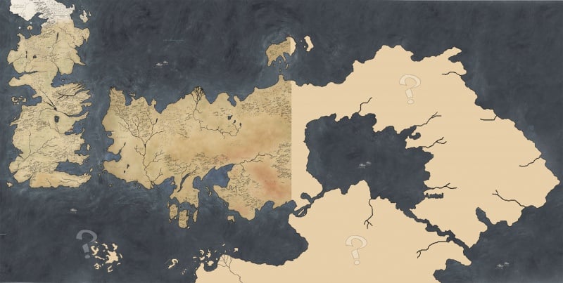
This a Speculative map.
The map of Westeros and Essos is Based on the latest HBO viewer guide map. The location of the Summer Isles, is based on comment GRRM made.
A set of canon maps will be released in The Lands of Ice and Fire. you can discuss speculative maps at the forum and update it here.
File history
Click on a date/time to view the file as it appeared at that time.
| Date/Time | Thumbnail | Dimensions | User | Comment | |
|---|---|---|---|---|---|
| current | 07:51, 5 April 2012 | | 3,314 × 1,670 (724 KB) | Mordin999 (talk | contribs) | A nother speculation, that feature an accurate Essos. You can discuss the various World map speculation here: http://asoiaf.westeros.org/index.php/topic/53776-a-map-of-the-world/ |
| 03:42, 1 March 2012 | 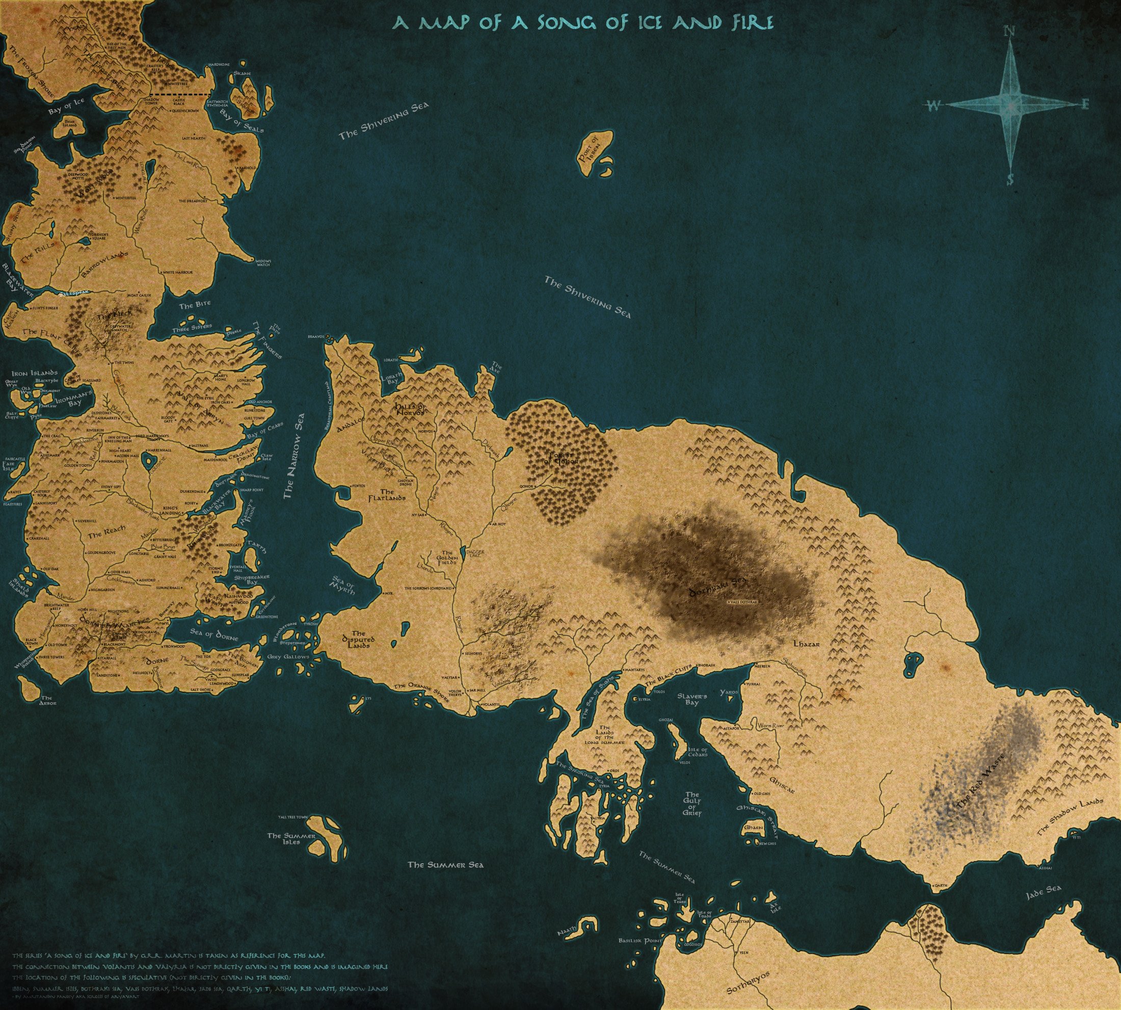 | 2,200 × 1,982 (1.47 MB) | ScrollsofA (talk | contribs) | Made on Photoshop. Since the complete world has never been revealed in the books, some creative liberties have been taken. The connection between Volantis and Valyria is imagined. Also, the locations of Ibben, Summer Isles, Jade Sea, Dothraki Sea, Lhaz |
- You cannot overwrite this file.
File usage
There are no pages that link to this file.