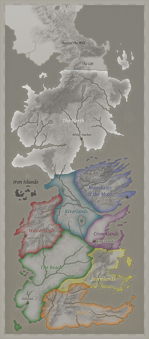
File: Westeros political map.jpg
From A Wiki of Ice and Fire
Size of this preview: 263 × 598 pixels. Other resolutions: 105 × 240 pixels | 498 × 1,132 pixels.
Original file (498 × 1,132 pixels, file size: 151 KB, MIME type: image/jpeg)
A speculative political map of the Seven Kingdom’s boundaries between the various regions, created by Tear in the course of creating his full map of the Seven Kingdoms.
| This work is copyrighted. | |
| The copyright holder has granted permission for this image to be used on A Wiki of Ice and Fire.
This permission does not extend to third parties. | |
| Additional information: | Copyright holder: Tear Permission: Anyone can use the map for their own fan projects, but nothing that is for-profit. Original: cartographersguild |
File history
Click on a date/time to view the file as it appeared at that time.
| Date/Time | Thumbnail | Dimensions | User | Comment | |
|---|---|---|---|---|---|
| current | 03:40, 10 September 2011 | | 498 × 1,132 (151 KB) | Mordin999 (talk | contribs) | {{Copyright tags|type=permission | permission = Anyone can use the map for their own fan projects, but nothing that is for-profit. | owner = [http://www.cartographersguild.com/member.php?11372-Tear Tear] | website = [http://www.cartographersguild.com c |
- You cannot overwrite this file.
File usage
There are no pages that link to this file.