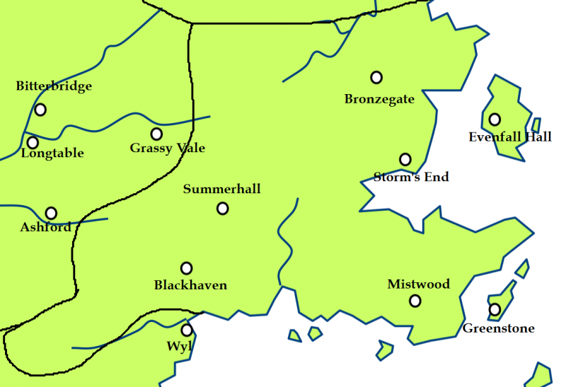
File: The Stormlands.png
From A Wiki of Ice and Fire

Size of this preview: 800 × 547 pixels. Other resolutions: 320 × 219 pixels | 1,130 × 773 pixels.
Original file (1,130 × 773 pixels, file size: 98 KB, MIME type: image/png)
Created by Scafloc from a map of Westeros on wikipedia[1].
![[1]](http://en.wikipedia.org/wiki/File:Westeros.png)
As the orginal wiki map: permission is granted to copy, distribute and/or modify this document under the terms of the GNU Free Documentation License, Version 1.2 or any later version published by the Free Software Foundation; with no Invariant Sections, no Front-Cover Texts, and no Back-Cover Texts.
A copy of the license is included in the section entitled "GNU Free Documentation License"[2].
File history
Click on a date/time to view the file as it appeared at that time.
| Date/Time | Thumbnail | Dimensions | User | Comment | |
|---|---|---|---|---|---|
| current | 15:02, 17 March 2011 | | 1,130 × 773 (98 KB) | Scafloc (talk | contribs) | Created by Scafloc from a map of Westeros on wikipedia[http://en.wikipedia.org/wiki/File:Westeros.png]. As the orginal wiki map: permission is granted to copy, distribute and/or modify this document under the terms of the [http://en |
- You cannot overwrite this file.
File usage
The following 29 pages link to this file:
- Blackhaven
- Bronzegate
- Cape Wrath
- Crow's Nest
- Dornish Marches
- Estermont
- Evenfall Hall
- Felwood
- Greenstone
- Griffin's Roost
- Haystack Hall
- Kingswood
- Mistwood
- Nightsong
- Rain House
- Rainwood
- Red Mountains
- Sea of Dorne
- Shipbreaker Bay
- Slayne
- Stonehelm
- Storm's End
- Stormlands
- Straits of Tarth
- Summerhall
- Tarth
- Weeping Town
- Wendwater
- User:SerMyLady/Maps