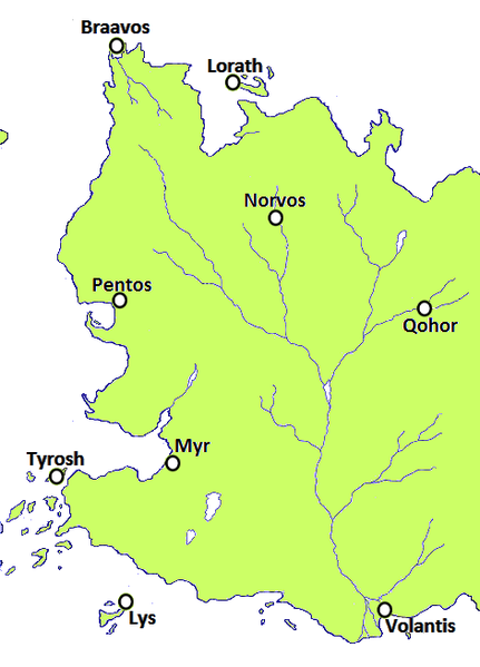
File: Free Cities.png
From A Wiki of Ice and Fire

Size of this preview: 431 × 599 pixels. Other resolutions: 172 × 240 pixels | 471 × 655 pixels.
Original file (471 × 655 pixels, file size: 48 KB, MIME type: image/png)
|
This file is licensed under the Creative Commons Attribution-ShareAlike 3.0 Unported license. |
In short, you are free to:
Under the following terms:
| |
| Additional information: | Based on map, which in turn based on poster at Westeros.org |
File history
Click on a date/time to view the file as it appeared at that time.
| Date/Time | Thumbnail | Dimensions | User | Comment | |
|---|---|---|---|---|---|
| current | 00:35, 19 May 2012 | | 471 × 655 (48 KB) | Mordin999 (talk | contribs) | |
| 10:43, 2 March 2012 | 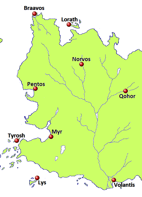 | 471 × 655 (48 KB) | Mordin999 (talk | contribs) | 1R |
- You cannot overwrite this file.
File usage
The following 44 pages link to this file:
- Andalos
- Ar Noy
- Bay of Pentos
- Bitterweed Bay
- Braavos
- Braavosian Coastland
- Chroyane
- Dagger Lake
- Darkwash
- Disputed Lands
- Flatlands
- Forest of Qohor
- Free Cities
- Ghoyan Drohe
- Golden Fields
- Hills of Norvos
- Lhorulu
- Little Rhoyne
- Lorassyon
- Lorath
- Lorath Bay
- Lys
- Myr
- Norvos
- Noyne
- Ny Sar
- Orange Shore
- Pentos
- Qhoyne
- Qohor
- Sar Mell
- Sarhoy
- Sea of Myrth
- Selhoru
- Selhorys
- Sorrows
- Tyrosh
- Upper Rhoyne
- Valysar
- Velvet Hills
- Volaena
- Volantis
- Volon Therys
- User:SerMyLady/Maps